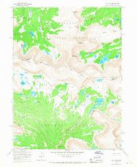
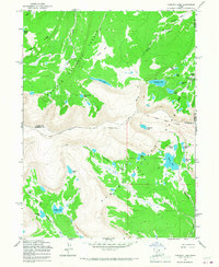
1965 Map of Fox Lake
USGS Topo · Published 1968About this map
Old Indian Treaty Boundary cuts a distinct line through this high-altitude wilderness, marking a historical division across the Uinta Mountains. This 1965 survey reveals a landscape defined by glacial basins and alpine summits, including North Burro Peak and South Burro Peak. A dense network of high lakes, such as Fox Lake, Island Lake, and the Kidney Lakes, feeds the headwaters of the Uinta River and Thompson Creek. The area is split between Wasatch National Forest and Ashley National Forest, with travel through the steep terrain limited to established pack trails and the Shale Dugway. The map captures the remote character of the Summit and Duchesne County line before modern recreation intensified, showing a primitive backcountry used primarily by pack teams and hikers navigating the Kabell Ridge and Thompson Pass.
Find a feature on this map
35 named features on this map. Tap any name to fly to it.
Don’t see what you’re looking for? This feature index may not catch every label — zoom into the map to look around manually.
Map Details
Editions of this 1965 Fox Lake Map
2 editions found
Other maps of this area

1885 · Uinta
USGS Topo · 1:250,000

1905 · Gilbert Peak
USGS Topo · 1:125,000

1906 · Gilbert Peak
USGS Topo · 1:125,000

1954 · Salt Lake City
USGS Topo · 1:250,000

1958 · Salt Lake City
USGS Topo · 1:250,000

1960 · Salt Lake City
USGS Topo · 1:250,000
1965 · Rasmussen Lakes
USGS Topo · 1:24,000

1965 · Mount Emmons
USGS Topo · 1:24,000
1965 · Kings Peak
USGS Topo · 1:24,000
1965 · Chepeta Lake
USGS Topo · 1:24,000