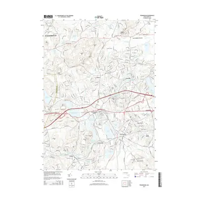
2015 Map of Framingham
USGS Topo · Published 2015About this map
Framingham Center and the bustling core of Framingham anchor this landscape, where the Sudbury River and a complex system of reservoirs define the local geography. The map illustrates a region heavily influenced by water management and historic industry, featuring the Sudbury Reservoir and Framingham Reservoir Number Three, alongside remnants of earlier milling eras at Grist Millpond and Carding Millpond. These water bodies are interspersed with significant local institutions like Framingham State Coll and the Sherborn Reformatory for Women-Annex Cem.
Find a feature on this map
84 named features on this map. Tap any name to fly to it.
Don’t see what you’re looking for? This feature index may not catch every label — zoom into the map to look around manually.
Map Details
Editions of this 2015 Framingham Map
This is the sole edition of this map. No revisions or reprints were ever made.
Other maps of this area

1886 · Blackstone
USGS Topo · 1:62,500

1886 · Framingham
USGS Topo · 1:62,500

1887 · Franklin
USGS Topo · 1:62,500

1887 · Marlboro
USGS Topo · 1:62,500

1889 · Marlboro
USGS Topo · 1:62,500

1889 · Blackstone
USGS Topo · 1:62,500

1889 · Franklin
USGS Topo · 1:62,500

1889 · Framingham
USGS Topo · 1:62,500

1893 · Franklin
USGS Topo · 1:62,500

1893 · Blackstone
USGS Topo · 1:62,500