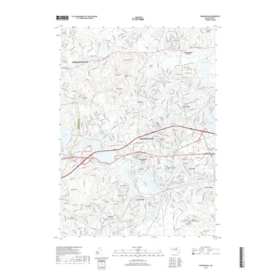
2018 Map of Framingham
USGS Topo · Published 2018About this map
Framingham and its surrounding suburban landscape are shown here in the late 2010s, centered on a dense network of residential streets and educational institutions. The area is anchored by Framingham State Univ and the Mass Bay Community College - Framingham Campus, illustrating the city's role as a regional educational hub. To the north, the landscape transitions into the hills of Marlborough, where landmarks like Tippling Rock and Mt Ward stand above a series of glacial ponds and wetlands, including Blandford Pond and the Grist Millpond. The map reveals a complex water management system, from the Sudbury Reservoir in the west to the expansive Lake Cochituate on the eastern edge. Local history and genealogy are well-represented by numerous significant burial sites such as the Edgell Grove Cem and Mausoleum, Saint Stephens Cem, and the specialized Sherborn Reformatory for Women - Annex Cem.
Find a feature on this map
81 named features on this map. Tap any name to fly to it.
Don’t see what you’re looking for? This feature index may not catch every label — zoom into the map to look around manually.
Map Details
Editions of this 2018 Framingham Map
This is the sole edition of this map. No revisions or reprints were ever made.
Other maps of this area

1886 · Blackstone
USGS Topo · 1:62,500

1886 · Framingham
USGS Topo · 1:62,500

1887 · Franklin
USGS Topo · 1:62,500

1887 · Marlboro
USGS Topo · 1:62,500

1889 · Marlboro
USGS Topo · 1:62,500

1889 · Blackstone
USGS Topo · 1:62,500

1889 · Franklin
USGS Topo · 1:62,500

1889 · Framingham
USGS Topo · 1:62,500

1893 · Franklin
USGS Topo · 1:62,500

1893 · Blackstone
USGS Topo · 1:62,500