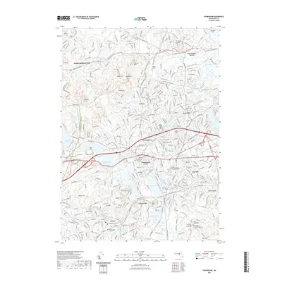
2021 Map of Framingham
USGS Topo · Published 2021About this map
Framingham serves as the central hub of this modern topographic record, where the suburban landscape is defined by its deep historical roots and complex water systems. The map details the evolution of the Sudbury River corridor, showing the transition of industrial sites like Saxonville and the preservation of large open spaces such as the Sudbury Reservoir and Lake Cochituate. Educational and institutional history is prominent, featuring the Framingham State University campus and the unique Reformatory for Women - Annex Cem. Local researchers will find significant genealogical data through numerous sites including Edgell Grove Cem and Mausoleum and the Clara Barton Burying Ground Cem. The transition from heavy rail to recreation is evident in the Mass Central/Wayside Rail Trl and the Cochituate Rail Trl, which now thread through established neighborhoods from Marlborough to Ashland.
Find a feature on this map
90 named features on this map. Tap any name to fly to it.
Don’t see what you’re looking for? This feature index may not catch every label — zoom into the map to look around manually.
Map Details
Editions of this 2021 Framingham Map
This is the sole edition of this map. No revisions or reprints were ever made.
Other maps of this area

1886 · Blackstone
USGS Topo · 1:62,500

1886 · Framingham
USGS Topo · 1:62,500

1887 · Franklin
USGS Topo · 1:62,500

1887 · Marlboro
USGS Topo · 1:62,500

1889 · Marlboro
USGS Topo · 1:62,500

1889 · Blackstone
USGS Topo · 1:62,500

1889 · Franklin
USGS Topo · 1:62,500

1889 · Framingham
USGS Topo · 1:62,500

1893 · Franklin
USGS Topo · 1:62,500

1893 · Blackstone
USGS Topo · 1:62,500