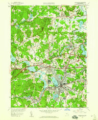
1950 Map of Framingham
USGS Topo · Published 1959About this map
Saxonville and the bustling core of Framingham dominate this mid-century landscape, reflecting a period of significant suburban development in Middlesex County. The map details a complex water management system featuring Lake Cochituate, Farm Pond, and several reservoirs including Reservoir No 1, Reservoir No 2, and Reservoir No 3. These water bodies are intertwined with an established rail network, where the Boston and Maine Railroad and the New York New Haven and Hartford Railroad intersect the growing road system, including the newly added Massachusetts Turnpike.
Find a feature on this map
89 named features on this map. Tap any name to fly to it.
Don’t see what you’re looking for? This feature index may not catch every label — zoom into the map to look around manually.
Map Details
Editions of this 1950 Framingham Map
This is the sole edition of this map. No revisions or reprints were ever made.
Other maps of this area

1886 · Blackstone
USGS Topo · 1:62,500

1886 · Framingham
USGS Topo · 1:62,500

1887 · Franklin
USGS Topo · 1:62,500

1887 · Marlboro
USGS Topo · 1:62,500

1889 · Marlboro
USGS Topo · 1:62,500

1889 · Blackstone
USGS Topo · 1:62,500

1889 · Franklin
USGS Topo · 1:62,500

1889 · Framingham
USGS Topo · 1:62,500

1893 · Franklin
USGS Topo · 1:62,500

1893 · Blackstone
USGS Topo · 1:62,500