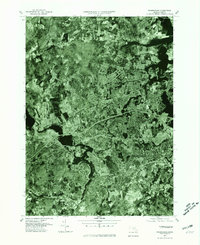
1977 Map of Framingham
USGS Topo · Published 1981About this map
The Sudbury River winds through this late-1970s orthophotoquad, revealing a suburban landscape in transition. This map uses rectified aerial photography to provide a literal view of the dense residential development and commercial corridors spreading across Framingham and West Natick. The bird's-eye perspective captures the distinct contrast between the built-up urban centers and the remaining wooded terrain around Nobscot Hill. To the west, the Sudbury Reservoir stands as a significant engineered water feature, its intricate shoreline clearly visible amidst the surrounding road networks and residential tracts. The imagery highlights the post-war growth patterns of the MetroWest region, from the clustered homes in South Sudbury to the industrial and transit-oriented development in Ashland, offering a precise record of the physical environment before further late-century expansion.
Find a feature on this map
7 named features on this map. Tap any name to fly to it.
Don’t see what you’re looking for? This feature index may not catch every label — zoom into the map to look around manually.
Map Details
Editions of this 1977 Framingham Map
This is the sole edition of this map. No revisions or reprints were ever made.
Other maps of this area

1886 · Blackstone
USGS Topo · 1:62,500

1886 · Framingham
USGS Topo · 1:62,500

1887 · Franklin
USGS Topo · 1:62,500

1887 · Marlboro
USGS Topo · 1:62,500

1889 · Marlboro
USGS Topo · 1:62,500

1889 · Blackstone
USGS Topo · 1:62,500

1889 · Franklin
USGS Topo · 1:62,500

1889 · Framingham
USGS Topo · 1:62,500

1893 · Franklin
USGS Topo · 1:62,500

1893 · Blackstone
USGS Topo · 1:62,500