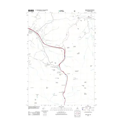
2012 Map of Franconia
USGS Topo · Published 2012About this map
The town of Franconia and its surrounding peaks define this mountainous landscape in Grafton County. The area is a major recreational hub, anchored by the Cannon Mountain Aerial Tramway and the extensive slopes of the Cannon Mountain Ski Area. Local history is preserved at Elmwood Cem and the grounds of Franconia College, while the high-altitude terrain is marked by significant wilderness landmarks. Notable features include the famous Franconia Notch pass, the Lonesome Lake Hut, and the rocky outcropping of Eagle Cliff. The Gale River system drains the northern slopes, passing through Five Corners and near the Cleveland Mountain Overlook. To the south, the terrain rises sharply toward the Franconia Ridge, featuring prominent peaks like Mount Lafayette and Mount Lincoln.
Find a feature on this map
90 named features on this map. Tap any name to fly to it.
Don’t see what you’re looking for? This feature index may not catch every label — zoom into the map to look around manually.
Map Details
Editions of this 2012 Franconia Map
This is the sole edition of this map. No revisions or reprints were ever made.
Other maps of this area

1900 · Whitefield
USGS Topo · 1:62,500

1929 · Moosilauke
USGS Topo · 1:62,500

1929 · Franconia
USGS Topo · 1:62,500

1931 · Littleton
USGS Topo · 1:62,500

1932 · Franconia
USGS Topo · 1:62,500

1932 · Littleton
USGS Topo · 1:48,000

1932 · Moosilauke
USGS Topo · 1:62,500

1935 · Littleton
USGS Topo · 1:62,500

1935 · Whitefield
USGS Topo · 1:48,000

1938 · Whitefield
USGS Topo · 1:62,500