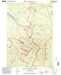
1995 Map of Franconia
USGS Topo · Published 2000About this map
Franconia and the high peaks of the White Mountain National Forest dominate this mid-1990s landscape, illustrating the evolution of New Hampshire's mountain tourism and recreation. The map captures the infrastructure of Franconia Notch State Park, including the famous Old Man of the Mountain profile and the Cannon Mountain Wintersports Area with its ski lifts and a Lookout Tower. Further south at Mitterstill Alpine Resort, the map details the intersection of recreation and rugged terrain.
Find a feature on this map
74 named features on this map. Tap any name to fly to it.
Don’t see what you’re looking for? This feature index may not catch every label — zoom into the map to look around manually.
Map Details
Editions of this 1995 Franconia Map
This is the sole edition of this map. No revisions or reprints were ever made.
Other maps of this area

1900 · Whitefield
USGS Topo · 1:62,500

1929 · Moosilauke
USGS Topo · 1:62,500

1929 · Franconia
USGS Topo · 1:62,500

1931 · Littleton
USGS Topo · 1:62,500

1932 · Franconia
USGS Topo · 1:62,500

1932 · Littleton
USGS Topo · 1:48,000

1932 · Moosilauke
USGS Topo · 1:62,500

1935 · Littleton
USGS Topo · 1:62,500

1935 · Whitefield
USGS Topo · 1:48,000

1938 · Whitefield
USGS Topo · 1:62,500