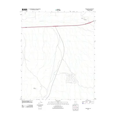
2011 Map of Franconia
USGS Topo · Published 2011About this map
The settlement of Franconia sits along a major transportation corridor in the arid basin of Mohave County, where modern infrastructure meets the stark geography of the Mohave Mountains. The local landscape is defined by the expansive Sacramento Wash, which cuts across the terrain north of the Interstate. While the northern portion of the map is largely open desert, the southern area reveals the planned residential grid of Havasu Heights, featuring a network of local roads including Havasu Heights Rd and Sierra Vista Dr. For genealogists and local historians, the Franconia Cemetery serves as a primary landmark for the early community, situated just north of the primary transit line. The contrast between the sparse, desert-spanning reach of Jub Rd and the concentrated residential development at Coronado Rd illustrates the evolving land use in this part of the Arizona desert during the early 21st century.
Find a feature on this map
14 named features on this map. Tap any name to fly to it.
Don’t see what you’re looking for? This feature index may not catch every label — zoom into the map to look around manually.
Map Details
Editions of this 2011 Franconia Map
This is the sole edition of this map. No revisions or reprints were ever made.
Other maps of this area

1903 · Needles
USGS Topo · 1:125,000

1904 · Needles Special
USGS Topo · 1:125,000

1927 · Yucca
USGS Topo · 1:62,500

1927 · Buck Mountains
USGS Topo · 1:62,500

1929 · Buck Mountains
USGS Topo · 1:62,500

1929 · Yucca
USGS Topo · 1:62,500

1943 · Topock
USGS Topo · 1:62,500

1950 · Topock
USGS Topo · 1:62,500

1951 · Topock
USGS Topo · 1:62,500

1954 · Needles
USGS Topo · 1:250,000