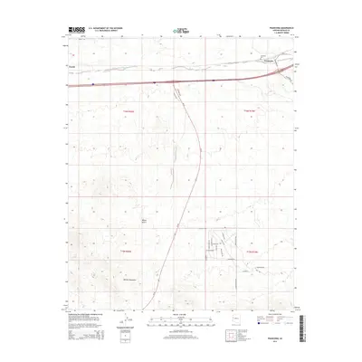
2014 Map of Franconia
USGS Topo · Published 2014About this map
Sacramento Wash carves a path through the arid landscape of the Mojave Desert in this high-desert region of Arizona. The small settlement of Franconia and the nearby Powell are central features, situated north of the Mohave Mountains. The map reveals a transition from the natural desert floor to more structured developments, particularly evident in the grid of local roads like Linden Rd and Coronado Rd near the southern boundary. For genealogists, the Franconia Cem serves as a critical point of interest for tracing family history in this corner of Mohave County. Modern transportation is dominated by the sweep of Az-95 and several rural access routes, including Franconia Rd and Regal Rd, which connect these sparse desert outposts.
Find a feature on this map
31 named features on this map. Tap any name to fly to it.
Don’t see what you’re looking for? This feature index may not catch every label — zoom into the map to look around manually.
Map Details
Editions of this 2014 Franconia Map
This is the sole edition of this map. No revisions or reprints were ever made.
Other maps of this area

1903 · Needles
USGS Topo · 1:125,000

1904 · Needles Special
USGS Topo · 1:125,000

1927 · Yucca
USGS Topo · 1:62,500

1927 · Buck Mountains
USGS Topo · 1:62,500

1929 · Buck Mountains
USGS Topo · 1:62,500

1929 · Yucca
USGS Topo · 1:62,500

1943 · Topock
USGS Topo · 1:62,500

1950 · Topock
USGS Topo · 1:62,500

1951 · Topock
USGS Topo · 1:62,500

1954 · Needles
USGS Topo · 1:250,000