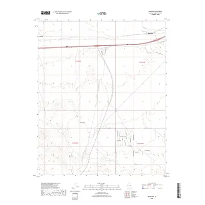
2018 Map of Franconia
USGS Topo · Published 2018About this map
The Mojave Desert and the foothills of the Mohave Mountains dominate this landscape in western Arizona. Modern residential growth is visible at Havasu Hts, where a dense grid of streets like Wagon Wheel Dr and Heights Blvd contrasts with the open terrain of the surrounding basin. To the north, the ephemeral drainage of Sacramento Wash runs parallel to the interstate corridor, passing the small settlement of Franconia and the Franconia Cem. This area preserves traces of earlier desert travel, including the historic alignment of the National Old Trails Rd, which preceded the modern highway system. The map captures the meeting point of high-voltage utility infrastructure along Powerline Rd and the localized development of the Havasu Heights community within the desert expanse.
Find a feature on this map
34 named features on this map. Tap any name to fly to it.
Don’t see what you’re looking for? This feature index may not catch every label — zoom into the map to look around manually.
Map Details
Editions of this 2018 Franconia Map
This is the sole edition of this map. No revisions or reprints were ever made.
Other maps of this area

1903 · Needles
USGS Topo · 1:125,000

1904 · Needles Special
USGS Topo · 1:125,000

1927 · Yucca
USGS Topo · 1:62,500

1927 · Buck Mountains
USGS Topo · 1:62,500

1929 · Buck Mountains
USGS Topo · 1:62,500

1929 · Yucca
USGS Topo · 1:62,500

1943 · Topock
USGS Topo · 1:62,500

1950 · Topock
USGS Topo · 1:62,500

1951 · Topock
USGS Topo · 1:62,500

1954 · Needles
USGS Topo · 1:250,000