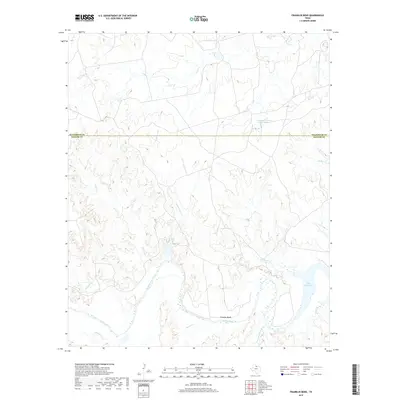
2019 Map of Franklin Bend
USGS Topo · Published 2019About this map
Waggoner Ranch Lake Number 1 sits in the northern reaches of this territory, where the boundary between Wilbarger and Baylor counties divides the landscape. This region of North Texas is defined by the drainage systems of the Wichita River, which meanders through the southern half of the map, creating the prominent Franklin Bend. The hydrological network is dense with tributaries including Hackberry Cr, Timber Cr, and Cottonwood Creek that feed into the river system.
Find a feature on this map
14 named features on this map. Tap any name to fly to it.
Don’t see what you’re looking for? This feature index may not catch every label — zoom into the map to look around manually.
Map Details
Editions of this 2019 Franklin Bend Map
This is the sole edition of this map. No revisions or reprints were ever made.
Other maps of this area

1917 · Beaver Creek
USGS Topo · 1:24,000

1920 · Beaver Creek
USGS Topo · 1:31,680

1932 · Dundee
USGS Topo · 1:62,500

1954 · Wichita Falls
USGS Topo · 1:250,000

1958 · Wichita Falls
USGS Topo · 1:250,000

1963 · Dundee
USGS Topo · 1:24,000

1966 · Franklin Bend
USGS Topo · 1:24,000

1966 · Fulda
USGS Topo · 1:24,000

1966 · Grayback
USGS Topo · 1:24,000
1966 · Lake Diversion
USGS Topo · 1:24,000