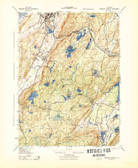
1943 Map of Franklin Furnace
USGS Topo · Published 1943About this map
Industrial operations and high-relief topography define this wartime survey of the New Jersey Highlands. The economic life of Franklin and Ogdensburg is clearly visible, dominated by the N J Zinc Co and the Iron Co Stack, while the Limestone Quarry and Simmons Coal Co point to the region's mineral extraction heritage. Infrastructure for the New York metropolitan area is evident in the sprawling Newark Reservoir and Newton Reservoir, highlighting the landscape's critical role in regional water management.
Find a feature on this map
65 named features on this map. Tap any name to fly to it.
Don’t see what you’re looking for? This feature index may not catch every label — zoom into the map to look around manually.
Map Details
Editions of this 1943 Franklin Furnace Map
This is the sole edition of this map. No revisions or reprints were ever made.
Other maps of this area

1888 · Franklin
USGS Topo · 1:62,500

1888 · Morristown
USGS Topo · 1:62,500

1888 · Lake Hopatcong
USGS Topo · 1:62,500

1891 · Greenwood Lake
USGS Topo · 1:62,500

1893 · Greenwood Lake
USGS Topo · 1:62,500

1894 · Morristown
USGS Topo · 1:62,500

1894 · Lake Hopatcong
USGS Topo · 1:62,500

1894 · Franklin
USGS Topo · 1:62,500

1897 · Franklin
USGS Topo · 1:62,500

1898 · Lake Hopatcong
USGS Topo · 1:62,500
Featured Places
- West Milford, NJ
- Vernon Township, NJ
- Rockaway Township, NJ
- Sparta Township, NJ
- Franklin, Hardyston Township