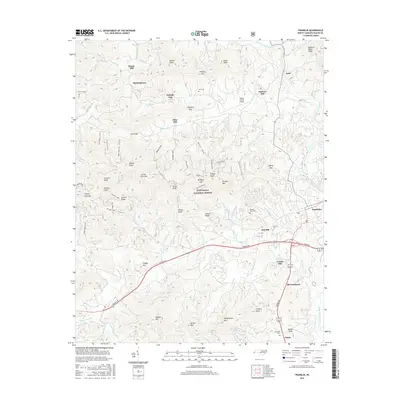
2016 Map of Franklin
USGS Topo · Published 2016About this map
Franklin serves as the focal point for this 2016 survey of Macon County, where the Little Tennessee River and Cartoogechaye Creek converge. The landscape is defined by the steep ridges of the Nantahala National Forest, including Trimont Mtn and Podgys Mtn. Historical land use is evident in the cluster of mill sites such as Deans Mill, Malonee Mill, and Cozads Mill, indicating a long-standing reliance on local water power. Small settlements like Burningtown and Blossomtown are connected by a network of winding roads including Murphy Rd and Georgia Rd. Local history is preserved in several burial grounds, including the Franklin Cem and Mc Ghee Cem, while modern infrastructure is represented by the Macon County Airport located near Iotla. The terrain is marked by numerous gaps and knobs, such as Parrish Gap and Bruce Knob, which have historically dictated the placement of mountain passes and homesites.
Find a feature on this map
95 named features on this map. Tap any name to fly to it.
Don’t see what you’re looking for? This feature index may not catch every label — zoom into the map to look around manually.
Map Details
Editions of this 2016 Franklin Map
This is the sole edition of this map. No revisions or reprints were ever made.
Other maps of this area

1891 · Cowee
USGS Topo · 1:125,000

1897 · Cowee
USGS Topo · 1:125,000

1907 · Cowee
USGS Topo · 1:125,000

1933 · Bryson
USGS Topo · 1:62,500

1933 · Bushnell
USGS Topo · 1:62,500

1935 · Franklin
USGS Topo · 1:24,000

1935 · Rainbow Springs
USGS Topo · 1:24,000

1935 · Prentiss
USGS Topo · 1:24,000

1935 · Burningtown Bald
USGS Topo · 1:24,000

1935 · Wayah Bald
USGS Topo · 1:48,000