1974 Map of Franklin NE
USGS Topo · Published 1977About this map
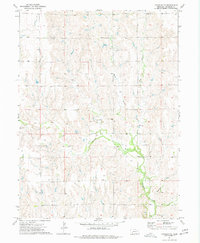
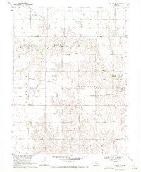
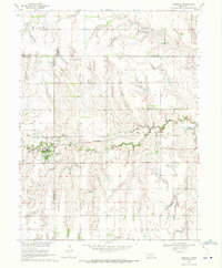
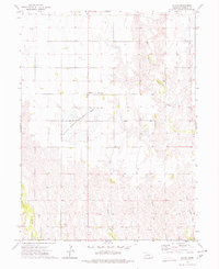
Spring Valley Ch and the nearby Spring Valley Sch stand as the social and educational anchors for this section of Franklin County during the mid-1970s. The landscape is defined by the complex drainage systems of Thompson Creek and Sassacus Creek, which are fed by several tributaries including the West Branch, Middle Branch, and East Branch. These waterways carve through the agricultural terrain, influencing the placement of local infrastructure and section boundaries. Evidence of the area's geological resources and small-scale local industry appears in the form of a Gravel Pit and a Sandpit, indicating localized quarrying operations that supported the development of the surrounding rural road network. This survey, based on 1973 aerial photography, provides a clear view of the rural settlement patterns and natural watercourses before modern agricultural changes altered the landscape.
Find a feature on this map
10 named features on this map. Tap any name to fly to it.
Don’t see what you’re looking for? This feature index may not catch every label — zoom into the map to look around manually.
Map Details
Editions of this 1974 Franklin NE Map
This is the sole edition of this map. No revisions or reprints were ever made.
Other maps of this area

1897 · Red Cloud
USGS Topo · 1:125,000
1940 · Red Cloud
USGS Topo · 1:62,500
1942 · Red Cloud
USGS Topo · 1:62,500

1955 · Grand Island
USGS Topo · 1:250,000

1957 · Grand Island
USGS Topo · 1:250,000

1958 · Grand Island
USGS Topo · 1:250,000
1969 · Upland
USGS Topo · 1:24,000
1969 · Upland SE
USGS Topo · 1:24,000
1969 · Campbell
USGS Topo · 1:24,000
1973 · Macon
USGS Topo · 1:24,000