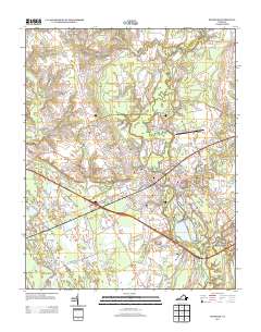
2013 Map of Franklin
USGS Topo · Published 2013About this map
The city of Franklin serves as the focal point of this 2013 landscape, where the Blackwater River and Nottoway River define the local geography. The map documents a transition from the urban density of the city center to the surrounding crossroads and rural enclaves such as Isaac, Edgehill, and Hunterdale. In the low-lying areas, several significant wetlands including Nottoway Swamp, Cypress Swamp, and Beaverdam Swamp illustrate the hydraulic character of this part of Virginia, which has long influenced local development and transportation patterns.
Find a feature on this map
99 named features on this map. Tap any name to fly to it.
Don’t see what you’re looking for? This feature index may not catch every label — zoom into the map to look around manually.
Map Details
Editions of this 2013 Franklin Map
This is the sole edition of this map. No revisions or reprints were ever made.
Other maps of this area

1919 · Homeville
USGS Topo · 1:48,000

1919 · Boykins
USGS Topo · 1:48,000

1920 · Holland
USGS Topo · 1:62,500

1920 · Ivor
USGS Topo · 1:62,500

1920 · Homeville
USGS Topo · 1:62,500

1920 · Boykins
USGS Topo · 1:62,500

1943 · Holland
USGS Topo · 1:62,500

1943 · Vicksville
USGS Topo · 1:31,680

1944 · Sedley
USGS Topo · 1:24,000

1944 · Zuni
USGS Topo · 1:24,000