2024 Map of Franklin
USGS Topo · Published 2024About this map
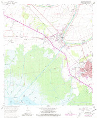
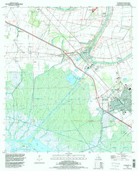
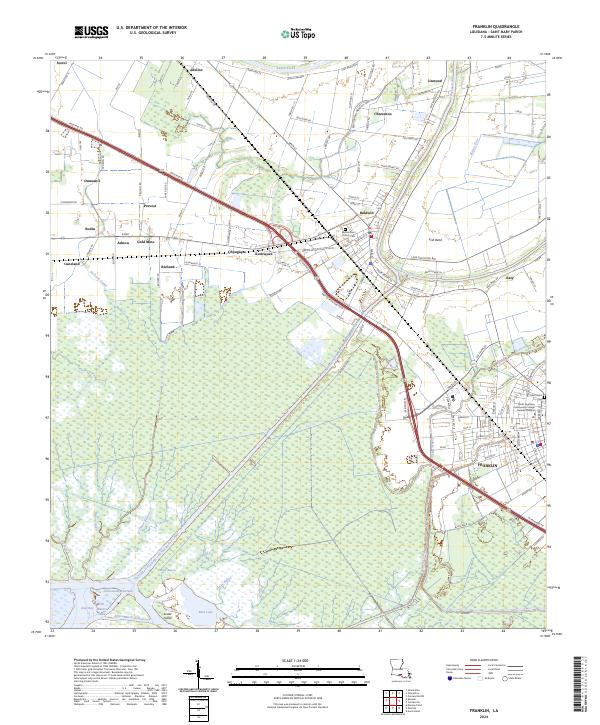
Bayou Teche winds through the heart of this Saint Mary Parish landscape, anchoring a string of historic settlements including Charenton, Baldwin, and Franklin. The map illustrates the complex intersection of natural bayous and industrial water management, featuring the Intracoastal Waterway and the Charenton Drainage and Navigation Canal cutting through the lowlands toward Jaws Bay. Agricultural patterns are evident along Cane Field Rd and near the Gold Mine locale, while the massive Bayou Teche National Wildlife Refuge preserves the wetlands south of the main corridor. Local heritage is concentrated at sites like the Sacred Heart Church Cem and the South Louisiana Community College Franklin Campus, reflecting the area's continued role as a regional center. The BNSF Railway and Hwy 182 parallel the water, following the high ground of the Irish Bend and connecting the smaller hamlets of Bodin, Ashton, and Rodriquez.
Find a feature on this map
123 named features on this map. Tap any name to fly to it.
Don’t see what you’re looking for? This feature index may not catch every label — zoom into the map to look around manually.
Map Details
Editions of this 2024 Franklin Map
This is the sole edition of this map. No revisions or reprints were ever made.
Historical Maps of Richard Through Time
3 maps found