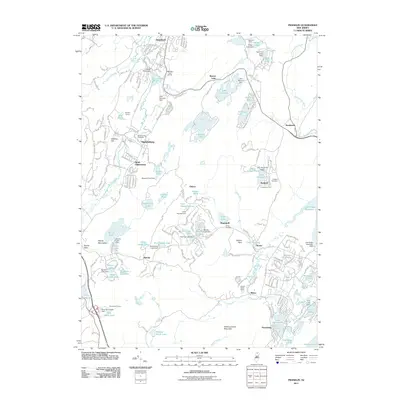
2011 Map of Franklin
USGS Topo · Published 2011About this map
Sterling Hill and the Wallkill River define the industrial and natural geography of this northern New Jersey corridor. The borough of Franklin and neighboring Ogdensburg are the primary centers of activity, served by the N Y S & W RR. This landscape is heavily shaped by water management, with numerous reservoirs and structures such as the Franklin Pond Dam and Lake Gerard Dam supporting local communities like Stockholm, Holland, and Milton.
Find a feature on this map
215 named features on this map. Tap any name to fly to it.
Don’t see what you’re looking for? This feature index may not catch every label — zoom into the map to look around manually.
Map Details
Editions of this 2011 Franklin Map
This is the sole edition of this map. No revisions or reprints were ever made.
Other maps of this area

1888 · Franklin
USGS Topo · 1:62,500

1888 · Morristown
USGS Topo · 1:62,500

1888 · Lake Hopatcong
USGS Topo · 1:62,500

1891 · Greenwood Lake
USGS Topo · 1:62,500

1893 · Greenwood Lake
USGS Topo · 1:62,500

1894 · Morristown
USGS Topo · 1:62,500

1894 · Lake Hopatcong
USGS Topo · 1:62,500

1894 · Franklin
USGS Topo · 1:62,500

1897 · Franklin
USGS Topo · 1:62,500

1898 · Lake Hopatcong
USGS Topo · 1:62,500
Featured Places
- West Milford, NJ
- Vernon Township, NJ
- Rockaway Township, NJ
- Sparta Township, NJ
- Franklin, Hardyston Township