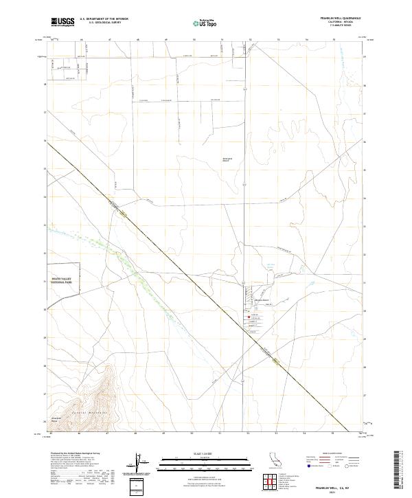
2021 Map of Franklin Well
USGS Topo · Published 2021About this map
The Amargosa River cuts diagonally across this arid landscape, marking the transition between the Amargosa Desert and the Mojave Desert. This border region, where Nye County, Nevada, and Inyo County, California meet, is anchored by significant protected lands, including the eastern reaches of Death Valley National Park and the ecologically vital Ash Meadows National Wildlife Refuge. The terrain is defined by the high elevations of the Funeral Mountains and Amargosa Range to the southwest, which stand in sharp contrast to the basin floor.
Find a feature on this map
50 named features on this map. Tap any name to fly to it.
Don’t see what you’re looking for? This feature index may not catch every label — zoom into the map to look around manually.
Map Details
Editions of this 2021 Franklin Well Map
This is the sole edition of this map. No revisions or reprints were ever made.
Other maps of this area

1908 · Furnace Creek
USGS Topo · 1:250,000

1910 · Furnace Creek
USGS Topo · 1:250,000

1942 · Skull Mountain
USGS Topo · 1:125,000

1942 · Bullfrog
USGS Topo · 1:125,000

1948 · Death Valley
USGS Topo · 1:250,000

1952 · Ash Meadows
USGS Topo · 1:62,500

1952 · Ryan
USGS Topo · 1:62,500

1952 · Big Dune
USGS Topo · 1:62,500

1954 · Death Valley
USGS Topo · 1:250,000

1956 · Death Valley
USGS Topo · 1:250,000