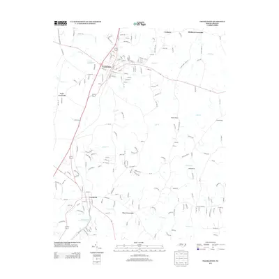
2013 Map of Franklinton
USGS Topo · Published 2013About this map
Franklinton serves as the primary hub of this 2013 survey, where the intersection of Us-1 and NC-56 anchors the local transportation network. The landscape is defined by its transition from the structured residential blocks of the town center to a series of rural nodes such as Mays Crossroads and Popes Crossroads. Water features are prominent throughout the region, with the Franklinton Reservoir situated northwest of town and the Little River flowing through the southern portion of the quadrangle. These waterways, along with Cedar Cr and Buffalo Cr, dictated the placement of historical crossings like Winston Bridge and Greens Bridge. South of the main settlement, Willowhaven Lake Number Two indicates later-twentieth-century residential development near Richland Cr. The map captures a moment of modern growth while maintaining the established rural framework of unincorporated communities like Needmore and Mitchiners Crossroads.
Find a feature on this map
30 named features on this map. Tap any name to fly to it.
Don’t see what you’re looking for? This feature index may not catch every label — zoom into the map to look around manually.
Map Details
Editions of this 2013 Franklinton Map
This is the sole edition of this map. No revisions or reprints were ever made.
Other maps of this area

1943 · Raleigh
USGS Topo · 1:62,500

1943 · Creedmoor
USGS Topo · 1:62,500

1944 · Creedmoor
USGS Topo · 1:62,500

1951 · Raleigh
USGS Topo · 1:62,500

1953 · Raleigh
USGS Topo · 1:250,000

1953 · Greensboro
USGS Topo · 1:250,000

1954 · Greensboro
USGS Topo · 1:250,000

1954 · Raleigh
USGS Topo · 1:250,000

1962 · Greensboro
USGS Topo · 1:250,000

1966 · Greensboro
USGS Topo · 1:250,000