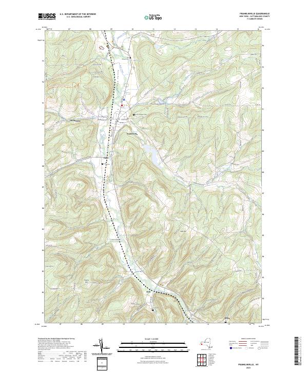
2023 Map of Franklinville
USGS Topo · Published 2023About this map
Ischua Valley serves as the primary corridor for settlement and transit in this portion of Cattaraugus County, with the village of Franklinville acting as the central hub. The landscape is defined by the winding course of Ischua Creek, which is fed by numerous tributaries including Saunders Creek and Gates Creek. This modern survey illustrates how historical footprints remain visible through a series of family and community burial grounds, such as Mount Prospect Cem and the Ten Broeck Cem north of the village.
Find a feature on this map
90 named features on this map. Tap any name to fly to it.
Don’t see what you’re looking for? This feature index may not catch every label — zoom into the map to look around manually.
Map Details
Editions of this 2023 Franklinville Map
This is the sole edition of this map. No revisions or reprints were ever made.
Other maps of this area

1898 · Olean
USGS Topo · 1:62,500

1900 · Salamanca
USGS Topo · 1:62,500

1924 · Ellicottville
USGS Topo · 1:62,500

1924 · Franklinville
USGS Topo · 1:62,500

1938 · Salamanca
USGS Topo · 1:62,500

1938 · Olean
USGS Topo · 1:62,500

1941 · Ellicottville
USGS Topo · 1:62,500

1942 · Franklinville
USGS Topo · 1:62,500

1943 · Olean
USGS Topo · 1:62,500

1943 · Salamanca
USGS Topo · 1:62,500