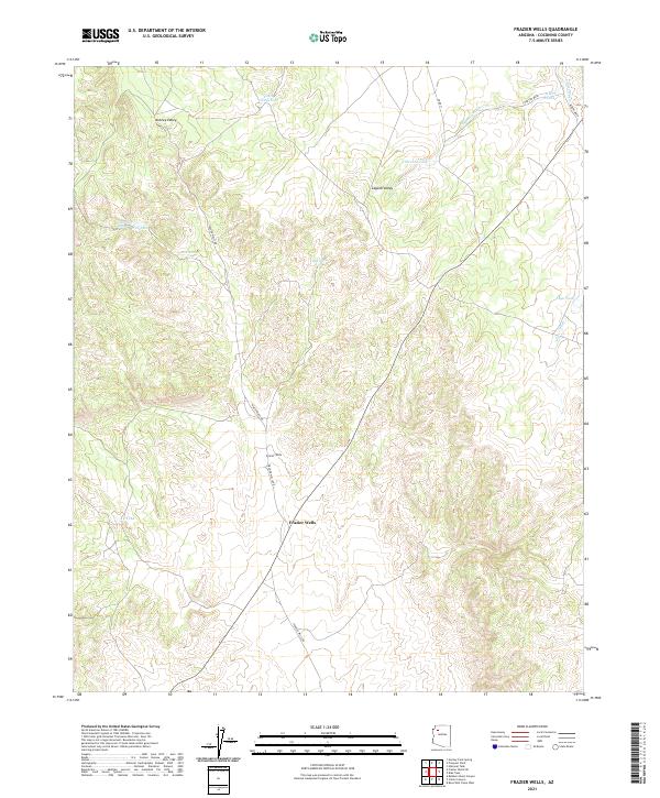
2021 Map of Frazier Wells
USGS Topo · Published 2021About this map
Frazier Wells occupies a central position in this high-altitude landscape of Coconino County, where the terrain transitions between the expansive Aubrey Valley to the northwest and Laguna Valley to the northeast. The environment is defined by its water management features, critical for ranching or seasonal habitation in this arid region. Numerous man-made improvements like Youth Camp Tank, Red Tank, and Albers Tank are scattered across the quadrangle, collecting runoff from drainage systems such as Thornton Wash and Albers Wash. Transport through this territory relies on a network of unpaved routes, most notably Frazier Wells Rd and Pine Springs Rd, which connect isolated water sources like Upper Pine Spring and Pine Spring. This 2021 survey illustrates the continued reliance on traditional water-catchment names and grazing infrastructure in a remote section of the Arizona backcountry.
Find a feature on this map
24 named features on this map. Tap any name to fly to it.
Don’t see what you’re looking for? This feature index may not catch every label — zoom into the map to look around manually.
Map Details
Editions of this 2021 Frazier Wells Map
This is the sole edition of this map. No revisions or reprints were ever made.
Other maps of this area

1886 · Diamond Creek
USGS Topo · 1:250,000

1886 · Chino
USGS Topo · 1:250,000

1891 · Chino
USGS Topo · 1:250,000

1892 · Diamond Creek
USGS Topo · 1:250,000

1948 · Williams
USGS Topo · 1:250,000

1954 · Williams
USGS Topo · 1:250,000

1956 · Williams
USGS Topo · 1:250,000

1960 · Williams
USGS Topo · 1:250,000

1961 · Williams
USGS Topo · 1:250,000
1967 · Hockey Puck Spring
USGS Topo · 1:24,000