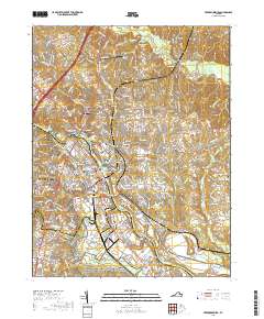
2019 Map of Fredericksburg
USGS Topo · Published 2019About this map
The Rappahannock River carves through this landscape, defining the boundaries between Stafford and Spotsylvania counties and shaping the development of Fredericksburg. This modern survey reveals the layers of memory preserved within the Fredericksburg and Spotsylvania County Battlefields Memorial National Military Park, including the solemn grounds of the Fredericksburg National Cem at Maryes Heights. The town's historical core is marked by landmarks like the Fredericksburg City Courthouse and the University of Mary Washington. On the opposite bank, the legacy of the Washington family is tied to Ferry Farm. Transportation infrastructure is central to the area's identity, from the CSX Transportation rail corridor to aviation hubs like Shannon Airport and Dogwood Airpark. Extensive cemeteries, such as the Saint Georges Episcopal Church Cem and White Oak Primitive Baptist Church Cem, provide essential anchor points for genealogical research in this long-settled region.
Find a feature on this map
94 named features on this map. Tap any name to fly to it.
Don’t see what you’re looking for? This feature index may not catch every label — zoom into the map to look around manually.
Map Details
Editions of this 2019 Fredericksburg Map
This is the sole edition of this map. No revisions or reprints were ever made.
Other maps of this area

1887 · Spottsylvania
USGS Topo · 1:125,000

1889 · Fredericksburg
USGS Topo · 1:125,000

1892 · Fredericksburg
USGS Topo · 1:125,000

1892 · Spottsylvania
USGS Topo · 1:125,000

1894 · Fredericksburg
USGS Topo · 1:125,000

1926 · Stafford
USGS Topo · 1:62,500

1931 · Stafford
USGS Topo · 1:62,500

1942 · Guinea
USGS Topo · 1:31,680

1942 · Spotsylania
USGS Topo · 1:31,680

1942 · Rappahannock Academy
USGS Topo · 1:31,680