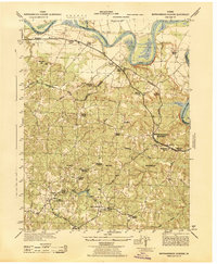
1942 Map of Rappahannock Academy
USGS Topo · Published 1944About this map
The Rappahannock River winds through the northern portion of this 1942 survey, defining the boundaries of Stafford, King George, and Caroline counties. The landscape is dominated by the sprawling A P Hill Military Reservation, which had only recently been established at the time of this mapping, fundamentally altering the rural character of the region. The map documents the A P Hill Military Hdqrs near Mica, alongside numerous family-named crossroads and farmsteads that predate the military's expansion into the area.
Find a feature on this map
42 named features on this map. Tap any name to fly to it.
Don’t see what you’re looking for? This feature index may not catch every label — zoom into the map to look around manually.
Map Details
Editions of this 1942 Rappahannock Academy Map
This is the sole edition of this map. No revisions or reprints were ever made.
Other maps of this area

1889 · Fredericksburg
USGS Topo · 1:125,000

1892 · Fredericksburg
USGS Topo · 1:125,000

1894 · Fredericksburg
USGS Topo · 1:125,000

1926 · Stafford
USGS Topo · 1:62,500

1931 · Stafford
USGS Topo · 1:62,500

1942 · Bowling Green
USGS Topo · 1:31,680

1942 · Upper Zion
USGS Topo · 1:31,680

1942 · Woodford
USGS Topo · 1:31,680

1942 · Guinea
USGS Topo · 1:31,680
1942 · Port Royal
USGS Topo · 1:31,680