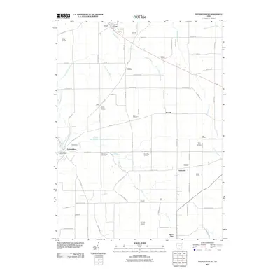
2010 Map of Fredericksburg
USGS Topo · Published 2010About this map
Apple Creek and Fredericksburg anchor this 2010 survey of a deeply agrarian landscape in Wayne and Holmes Counties. The map reveals a high density of small family and farm burial grounds, such as the Peter Miller Farm Cemetery, Joseph Helmuth Farm Cemetery, and Emanuel Troyer Farm Cemetery, reflecting the enduring settlement patterns and genealogical heritage of the local community. Small crossroads hamlets like Calamoutier and Traceys Corners dot the grid of township roads, while Mount Hope sits at the southern edge. The terrain is defined by the headwaters of Salt Creek and Apple Creek, with artificial water bodies like Spring Valley Lake and Meadow Lake adding to the rural geography. North of the Apple Creek Post Office, the Davies Air Field represents one of the few modern infrastructural markers in an area otherwise dedicated to farming and localized industry.
Find a feature on this map
79 named features on this map. Tap any name to fly to it.
Don’t see what you’re looking for? This feature index may not catch every label — zoom into the map to look around manually.
Map Details
Editions of this 2010 Fredericksburg Map
This is the sole edition of this map. No revisions or reprints were ever made.
Other maps of this area

1901 · Massillon
USGS Topo · 1:62,500

1901 · Wooster
USGS Topo · 1:62,500

1903 · Massillon
USGS Topo · 1:62,500

1903 · Wooster
USGS Topo · 1:62,500

1914 · Navarre
USGS Topo · 1:62,500

1915 · Millersburg
USGS Topo · 1:62,500

1943 · Millersburg
USGS Topo · 1:62,500

1944 · Navarre
USGS Topo · 1:62,500

1951 · Canton
USGS Topo · 1:250,000

1953 · Canton
USGS Topo · 1:250,000