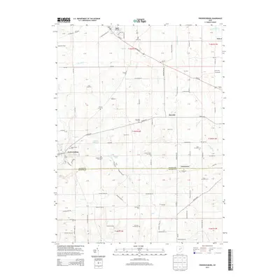
2013 Map of Fredericksburg
USGS Topo · Published 2013About this map
Apple Creek and Fredericksburg anchor this 2013 survey of the rural borderlands between Wayne and Holmes Counties. The landscape is deeply defined by established family farms and a dense concentration of community burial grounds, reflecting the long-standing agricultural heritage of the region. Distinctive sites like the Peter Miller Farm Cem and Joseph Helmuth Farm Cem are interspersed among larger holdings like Siedel Farm and the Valley Creek Farm. The terrain is drained by several branches of Salt Cr and Apple Cr, which feed local water bodies such as Spring Valley Lake and Meadow Lake. Small settlements like Maysville and Calamoutier dot the grid of township roads, maintaining their identity alongside specialized landmarks including Davies Air Field and several community-specific cemeteries like the Noah Petersheim Cem and Simon Slabach Cem.
Find a feature on this map
149 named features on this map. Tap any name to fly to it.
Don’t see what you’re looking for? This feature index may not catch every label — zoom into the map to look around manually.
Map Details
Editions of this 2013 Fredericksburg Map
This is the sole edition of this map. No revisions or reprints were ever made.
Other maps of this area

1901 · Massillon
USGS Topo · 1:62,500

1901 · Wooster
USGS Topo · 1:62,500

1903 · Massillon
USGS Topo · 1:62,500

1903 · Wooster
USGS Topo · 1:62,500

1914 · Navarre
USGS Topo · 1:62,500

1915 · Millersburg
USGS Topo · 1:62,500

1943 · Millersburg
USGS Topo · 1:62,500

1944 · Navarre
USGS Topo · 1:62,500

1951 · Canton
USGS Topo · 1:250,000

1953 · Canton
USGS Topo · 1:250,000