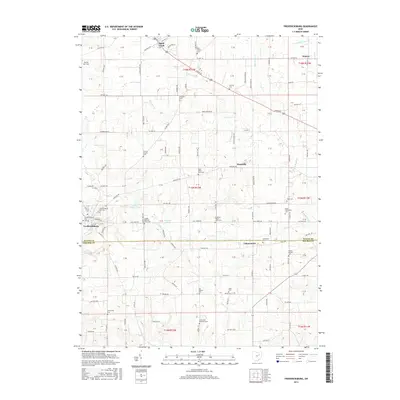
2016 Map of Fredericksburg
USGS Topo · Published 2016About this map
Apple Creek and Fredericksburg anchor this 2016 survey of the southeastern corner of Wayne County, illustrating a landscape defined by traditional farming and rural hamlets. The terrain is marked by numerous family-run homesteads and small burial grounds, such as the Peter Miller Farm Cem and Noah Petersheim Cem, which reflect the deep-rooted genealogical history of the local community. The drainage patterns of Salt Creek and Apple Creek carve through the countryside, feeding into local reservoirs like Spring Valley Lake and Meadow Lake.
Find a feature on this map
102 named features on this map. Tap any name to fly to it.
Don’t see what you’re looking for? This feature index may not catch every label — zoom into the map to look around manually.
Map Details
Editions of this 2016 Fredericksburg Map
This is the sole edition of this map. No revisions or reprints were ever made.
Other maps of this area

1901 · Massillon
USGS Topo · 1:62,500

1901 · Wooster
USGS Topo · 1:62,500

1903 · Massillon
USGS Topo · 1:62,500

1903 · Wooster
USGS Topo · 1:62,500

1914 · Navarre
USGS Topo · 1:62,500

1915 · Millersburg
USGS Topo · 1:62,500

1943 · Millersburg
USGS Topo · 1:62,500

1944 · Navarre
USGS Topo · 1:62,500

1951 · Canton
USGS Topo · 1:250,000

1953 · Canton
USGS Topo · 1:250,000