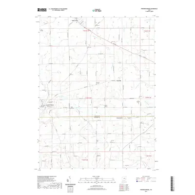
2019 Map of Fredericksburg
USGS Topo · Published 2019About this map
Apple Creek and Fredericksburg anchor this 2019 survey of the Wayne and Holmes County line, a region defined by its dispersed agricultural settlements and numerous small family burial grounds. The landscape is deeply carved by watercourses like Salt Creek and Little Sugar Creek, which separate high-ground farms from the valley floors. Genealogists will find a high density of private farm cemeteries, such as the Peter Miller Farm Cem, Joseph Helmuth Farm Cem, and Noah Petersheim Cem, indicating a long-standing tradition of multi-generational land ownership. The presence of Davies Air Field northwest of Apple Creek contrasts the otherwise traditional rural character of the area. Small hamlets like Maysville and Calamoutier dot the intersections of township roads, while Spring Valley Lake and Meadow Lake provide recreational or agricultural water resources amidst the rolling terrain.
Find a feature on this map
99 named features on this map. Tap any name to fly to it.
Don’t see what you’re looking for? This feature index may not catch every label — zoom into the map to look around manually.
Map Details
Editions of this 2019 Fredericksburg Map
This is the sole edition of this map. No revisions or reprints were ever made.
Other maps of this area

1901 · Massillon
USGS Topo · 1:62,500

1901 · Wooster
USGS Topo · 1:62,500

1903 · Massillon
USGS Topo · 1:62,500

1903 · Wooster
USGS Topo · 1:62,500

1914 · Navarre
USGS Topo · 1:62,500

1915 · Millersburg
USGS Topo · 1:62,500

1943 · Millersburg
USGS Topo · 1:62,500

1944 · Navarre
USGS Topo · 1:62,500

1951 · Canton
USGS Topo · 1:250,000

1953 · Canton
USGS Topo · 1:250,000