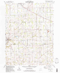
1994 Map of Fredricksburg
USGS Topo · Published 1998About this map
Fredericksburg and Apple Creek anchor this landscape along the border of Wayne and Holmes counties during the mid-1990s. The region is defined by a dense network of country schools, including Waynedale Sch, Fountain Nook Sch, and Oak Grove Sch, reflecting a persistent rural social structure. Topography is shaped by the winding courses of Sugar Creek and Salt Creek, with Spring Valley Lake and Meadow Lake providing notable water features near the central settlements. Evidence of local industry is visible through numerous Gas Wells and several Strip Mines and Strip Mines in the southern sections. Small ecclesiastical landmarks like Maysville Ch and the Church of God emphasize the importance of local parishes in the East Union and Salt Creek townships.
Find a feature on this map
37 named features on this map. Tap any name to fly to it.
Don’t see what you’re looking for? This feature index may not catch every label — zoom into the map to look around manually.
Map Details
Editions of this 1994 Fredricksburg Map
This is the sole edition of this map. No revisions or reprints were ever made.
Other maps of this area

1901 · Massillon
USGS Topo · 1:62,500

1901 · Wooster
USGS Topo · 1:62,500

1903 · Massillon
USGS Topo · 1:62,500

1903 · Wooster
USGS Topo · 1:62,500

1914 · Navarre
USGS Topo · 1:62,500

1915 · Millersburg
USGS Topo · 1:62,500

1943 · Millersburg
USGS Topo · 1:62,500

1944 · Navarre
USGS Topo · 1:62,500

1951 · Canton
USGS Topo · 1:250,000

1953 · Canton
USGS Topo · 1:250,000