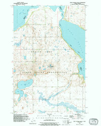
1994 Map of Free Peoples Lake
USGS Topo · Published 1995About this map
The Sioux Indian Reservation dominates the southern landscape of this North Dakota survey, a region defined by its complex glacial hydrology and expansive prairies. Centered between the fragmented shores of South Minnewaukan Lake and East Devils Lake, the terrain is punctuated by numerous smaller water bodies, including Free Peoples Lake and Elbow Lake. This area reflects a specialized conservation and community layout, specifically seen in the National Waterfowl Production Area.
Find a feature on this map
16 named features on this map. Tap any name to fly to it.
Don’t see what you’re looking for? This feature index may not catch every label — zoom into the map to look around manually.
Map Details
Editions of this 1994 Free Peoples Lake Map
This is the sole edition of this map. No revisions or reprints were ever made.
Other maps of this area

1928 · Tokio
USGS Topo · 1:62,500

1930 · Hamar
USGS Topo · 1:62,500

1931 · Tokio
USGS Topo · 1:62,500

1931 · Devils Lake
USGS Topo · 1:62,500

1950 · Tokio
USGS Topo · 1:24,000

1950 · Devils Lake
USGS Topo · 1:62,500

1950 · Devils Lake Mountain
USGS Topo · 1:24,000

1951 · Crary
USGS Topo · 1:24,000

1951 · Devils Lake Mountain
USGS Topo · 1:24,000

1951 · Devils Lake
USGS Topo · 1:24,000