Loading...
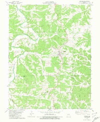
Loading map...1981 Map of Freeburg
USGS Topo · Published 1981About this map
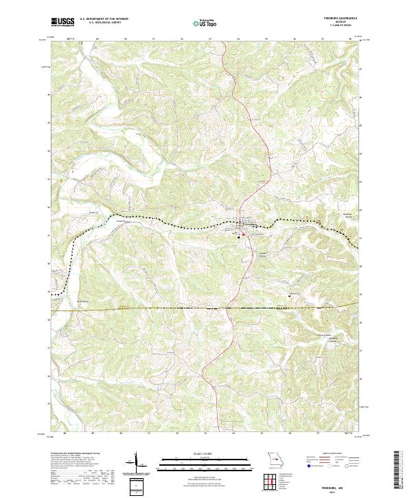
Freeburg serves as the central hub of this Missouri landscape, situated near the boundary where Osage Co and Maries Co meet. The town is marked by local landmarks like the Holy Family Cem and industrial footprints including a nearby Quarry and Kilns. The terrain is deeply carved by a network of drainage systems, most notably the winding Maries River which defines the western edge of the area.
Find a feature on this map
22 named features on this map. Tap any name to fly to it.
Don’t see what you’re looking for? This feature index may not catch every label — zoom into the map to look around manually.
Map Details
Date Portrayed1981
Date Published1981
PublisherU.S. Geological Survey
Map TypeTopographic
Scale1:24,000
Physical Dimensions21.9 x 26.8 inches
Editions of this 1981 Freeburg Map
This is the sole edition of this map. No revisions or reprints were ever made.
Historical Maps of Freeburg Through Time
5 maps found
Featured Locations
Source Details
SourceU.S. Geological Survey
CopyrightPublic Domain