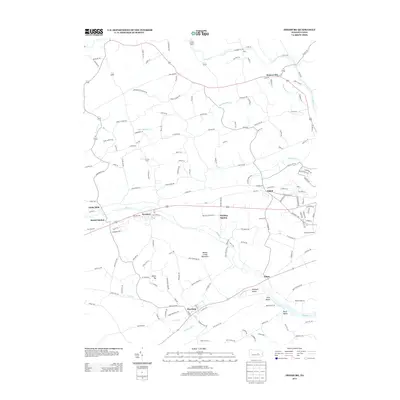
2013 Map of Freeburg
USGS Topo · Published 2013About this map
Freeburg and the agricultural valleys of Snyder County define this landscape along the Susquehecka Cr and Middle Cr. The settlement pattern reflects a deeply rooted rural economy, where small villages like Kratzerville and Kreamer are connected by a network of winding local roads and runs. Significant topographic relief is provided by Middle Creek Mountain, which separates the northern valley drainage of Monongahela Cr from the southern reaches of Dry Run. Historical transportation corridors are evidenced by names like Meiser Station and Pawling Station, while industrial history is noted at Globe Mills. This modern survey documents the persistence of these small communities and named ridges, which continue to anchor the region's geography between the larger watercourses of Penns Cr and Tuscarora Cr.
Find a feature on this map
152 named features on this map. Tap any name to fly to it.
Don’t see what you’re looking for? This feature index may not catch every label — zoom into the map to look around manually.
Map Details
Editions of this 2013 Freeburg Map
This is the sole edition of this map. No revisions or reprints were ever made.
Other maps of this area

1893 · Sunbury
USGS Topo · 1:62,500

1893 · Millersburg
USGS Topo · 1:62,500

1907 · Millerstown
USGS Topo · 1:62,500

1938 · Mifflinburg
USGS Topo · 1:48,000

1943 · Millerstown
USGS Topo · 1:62,500

1943 · Millersburg
USGS Topo · 1:62,500

1943 · Sunbury
USGS Topo · 1:62,500

1943 · Mifflinburg
USGS Topo · 1:62,500
1947 · Pillow
USGS Topo · 1:24,000
1947 · Dalmatia
USGS Topo · 1:24,000