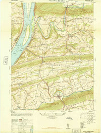
1947 Map of Pillow
USGS Topo · Published 1947About this map
The Susquehanna River defines the western edge of this 1947 landscape, where a series of prominent landmasses like Hoover Island and Whites Island break the wide river channel near Herndon. The topography is dominated by the long, parallel ridges of Mahanoy Mountain, Hoof Ander Ridge, and Fisher Ridge, which dictate the east-west orientation of local travel and agriculture. Small settlements and crossroads like Pillow, Mandata, and Hickory Cross Roads are connected by rural roads that navigate these elevations.
Find a feature on this map
53 named features on this map. Tap any name to fly to it.
Don’t see what you’re looking for? This feature index may not catch every label — zoom into the map to look around manually.
Map Details
Editions of this 1947 Pillow Map
3 editions found
Other maps of this area

1892 · Lykens
USGS Topo · 1:62,500

1892 · Shamokin
USGS Topo · 1:62,500

1893 · Sunbury
USGS Topo · 1:62,500

1893 · Lykens
USGS Topo · 1:62,500

1893 · Shamokin
USGS Topo · 1:62,500

1893 · Millersburg
USGS Topo · 1:62,500

1943 · Millersburg
USGS Topo · 1:62,500

1943 · Lykens
USGS Topo · 1:62,500

1943 · Shamokin
USGS Topo · 1:62,500

1943 · Sunbury
USGS Topo · 1:62,500