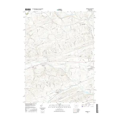
2016 Map of Freeburg
USGS Topo · Published 2016About this map
Freeburg and the surrounding Snyder County countryside are defined by long, parallel valleys and ridges, a classic Pennsylvania landscape. These corridors, including Pleasant Valley and Neitz Valley, guide the local road network and the flow of waterways like Middle Creek. To the east, the edge of Selinsgrove appears near the Susquehanna University campus, marking the transition from agricultural land to more concentrated settlement. The map highlights numerous rural hubs such as Kratzerville, Kreamer, and Kantz, each connected by a web of named local routes like Applebutter Hollow Road and Little Mexico Road. Genealogists may find value in the scattered burial grounds that serve these communities, including Globe Mills Cemetery, Fairview Cemetery, and Evergreen Cemetery, often located on the slopes of prominent elevations like Mid Creek Mountain or Bake Oven Hill.
Find a feature on this map
155 named features on this map. Tap any name to fly to it.
Don’t see what you’re looking for? This feature index may not catch every label — zoom into the map to look around manually.
Map Details
Editions of this 2016 Freeburg Map
This is the sole edition of this map. No revisions or reprints were ever made.
Other maps of this area

1893 · Sunbury
USGS Topo · 1:62,500

1893 · Millersburg
USGS Topo · 1:62,500

1907 · Millerstown
USGS Topo · 1:62,500

1938 · Mifflinburg
USGS Topo · 1:48,000

1943 · Millerstown
USGS Topo · 1:62,500

1943 · Millersburg
USGS Topo · 1:62,500

1943 · Sunbury
USGS Topo · 1:62,500

1943 · Mifflinburg
USGS Topo · 1:62,500
1947 · Pillow
USGS Topo · 1:24,000
1947 · Dalmatia
USGS Topo · 1:24,000