2023 Map of Freeburg
USGS Topo · Published 2023About this map
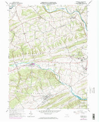
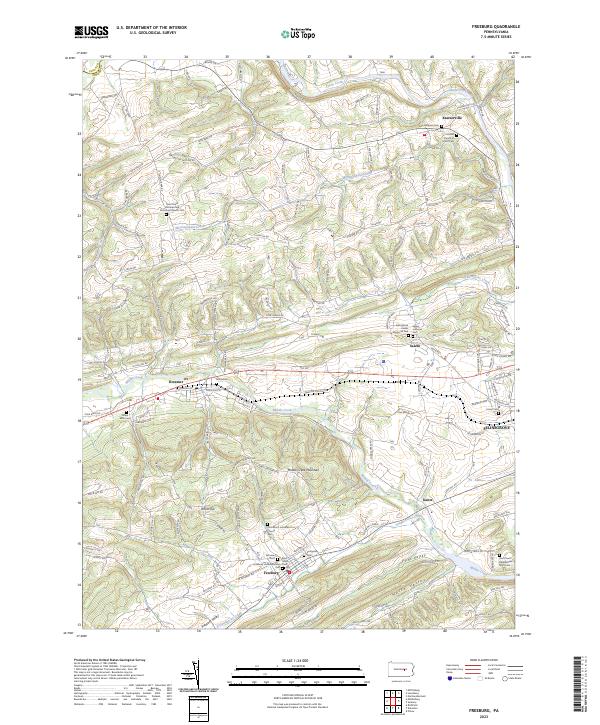
Middle Creek Mountain serves as a central spine through this central Snyder County landscape, dividing the agricultural valleys and small villages of the region. To the north, the settlement of Kreamer sits along Middle Creek, while Freeburg occupies the southern valley floor below White Top. The area is notably dense with community landmarks, featuring a high concentration of Lutheran and Reformed congregations and their associated burial grounds, such as Saint Pauls Lutheran and Reformed Church Cem and Zion Morris Lutheran Church Cem. The road network, including the historic Old 522 and numerous named hollows like Applebutter Hollow Rd, reflects a long-established rural layout. On the eastern edge, the topography shifts toward the Susquehecka Creek drainage and the outskirts of Selinsgrove, marking the transition toward the larger river settlements.
Find a feature on this map
99 named features on this map. Tap any name to fly to it.
Don’t see what you’re looking for? This feature index may not catch every label — zoom into the map to look around manually.
Map Details
Editions of this 2023 Freeburg Map
This is the sole edition of this map. No revisions or reprints were ever made.