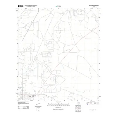
2010 Map of Freer North
USGS Topo · Published 2010About this map
Freer serves as the primary hub in this portion of Duval County, characterized by a grid-like expansion of residential areas such as the East Pearson Street Colonia and Coronado Perez Addition Colonia. The landscape is defined by the ephemeral drainage of Government Wells Creek and Tarancahuas Creek, which traverse the scrubland and ranching terrain of South Texas. Evidence of local community and infrastructure is found in the Hahl Memorial Cemetery and the Duval-Freer Airport, illustrating the town's role as a regional center for aviation and commerce. The map provides a detailed view of the local road network, including Co RD 403 and Co RD 325, which connect the concentrated settlement of Freer to the surrounding rural landscape.
Find a feature on this map
9 named features on this map. Tap any name to fly to it.
Don’t see what you’re looking for? This feature index may not catch every label — zoom into the map to look around manually.
Map Details
Editions of this 2010 Freer North Map
This is the sole edition of this map. No revisions or reprints were ever made.
Other maps of this area

1920 · Mikeska
USGS Topo · 1:125,000

1937 · Loma Alta
USGS Topo · 1:62,500

1953 · Crystal City
USGS Topo · 1:250,000

1955 · Crystal City
USGS Topo · 1:250,000

1956 · Rosita Ranch
USGS Topo · 1:62,500

1956 · Freer
USGS Topo · 1:62,500

1956 · Laredo
USGS Topo · 1:250,000

1961 · Crystal City
USGS Topo · 1:250,000

1968 · Crystal City
USGS Topo · 1:250,000
1968 · Rosita
USGS Topo · 1:24,000