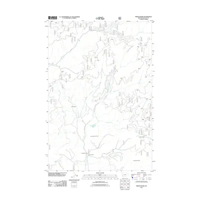
2011 Map of French Basin
USGS Topo · Published 2011About this map
French Basin forms a central drainage corridor in this part of Ravalli County, where water features and mountain terrain dictate the movement of roads and trails. The hydrologic landscape is defined by the Shining Mountain Dam and Schoolmarm Lake, supported by a dense network of tributaries including Rye Creek, Lyman Creek, and the North Fork Cameron Creek. Higher elevations are marked by landmarks like Shirley Mountain and the distinctively named Weird Tom, while the Guide Saddle provides a natural crossing point near Guide Creek. The road network is primarily composed of forest service routes such as Skalkaho Rd and French Basin Rd, which navigate the contours of Sawdust Gulch and Pasture Draw. This survey captures a region where the names, such as Clough Springs and Big Corral, reflect a history of water management and livestock usage in the Montana high country.
Find a feature on this map
22 named features on this map. Tap any name to fly to it.
Don’t see what you’re looking for? This feature index may not catch every label — zoom into the map to look around manually.
Map Details
Editions of this 2011 French Basin Map
This is the sole edition of this map. No revisions or reprints were ever made.
Other maps of this area

1901 · Hamilton
USGS Topo · 1:125,000

1909 · Sapphire
USGS Topo · 1:125,000

1947 · Butte
USGS Topo · 1:250,000

1955 · Dillon
USGS Topo · 1:250,000

1956 · Elk City
USGS Topo · 1:250,000

1956 · Hamilton
USGS Topo · 1:250,000

1957 · Dillon
USGS Topo · 1:250,000

1958 · Butte
USGS Topo · 1:250,000

1958 · Dillon
USGS Topo · 1:250,000

1959 · Hamilton
USGS Topo · 1:250,000