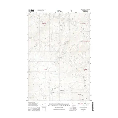
2014 Map of French Basin
USGS Topo · Published 2014About this map
French Basin serves as the focal point of this high-country landscape within the Bitterroot National Forest during the early twenty-first century. The area is defined by its complex drainage network, where Rye Creek and Cameron Creek carve through the terrain, fed by numerous seasonal flows such as Hart Creek and Doran Creek. These watercourses dictate the placement of local infrastructure, including French Basin Road and Skalkaho Rye Road, which follow the natural contours of the mountain valleys. Higher elevations are marked by landmarks like Shirley Mountain and the high pass at Guide Saddle. The presence of Schoolmarm Lake and Clough Springs highlights the diverse water sources tucked into the gulches and draws of Ravalli County. The naming conventions throughout the quadrangle, from Sawdust Gulch to Pasture Draw, suggest a history of local land use tied to timber and grazing.
Find a feature on this map
29 named features on this map. Tap any name to fly to it.
Don’t see what you’re looking for? This feature index may not catch every label — zoom into the map to look around manually.
Map Details
Editions of this 2014 French Basin Map
This is the sole edition of this map. No revisions or reprints were ever made.
Other maps of this area

1901 · Hamilton
USGS Topo · 1:125,000

1909 · Sapphire
USGS Topo · 1:125,000

1947 · Butte
USGS Topo · 1:250,000

1955 · Dillon
USGS Topo · 1:250,000

1956 · Elk City
USGS Topo · 1:250,000

1956 · Hamilton
USGS Topo · 1:250,000

1957 · Dillon
USGS Topo · 1:250,000

1958 · Butte
USGS Topo · 1:250,000

1958 · Dillon
USGS Topo · 1:250,000

1959 · Hamilton
USGS Topo · 1:250,000