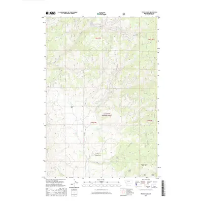
2017 Map of French Basin
USGS Topo · Published 2017About this map
Bitterroot National Forest dominates this mountain landscape in Ravalli County, where the topography is defined by the high-elevation depressions of the French Basin. The area's hydrology is complex, centered on Rye Creek in the north and the branching network of Cameron Cr and its tributaries, including Lyman Cr and Hart Cr. At the heart of the forest lies Schoolmarm Lake, situated just north of the perennial flow at Clough Springs. The map provides a detailed look at the drainage patterns of the eastern Bitterroot range, revealing numerous locally named features such as Sawdust Gulch, Bunch Gulch, and Tuff Draw. In the southeast, the terrain ascends toward the peak of Georges Shirley Draw Mtn, overlooking a network of forest access routes like the Skalkaho Rye Rd and Pasture Draw Rd.
Find a feature on this map
25 named features on this map. Tap any name to fly to it.
Don’t see what you’re looking for? This feature index may not catch every label — zoom into the map to look around manually.
Map Details
Editions of this 2017 French Basin Map
This is the sole edition of this map. No revisions or reprints were ever made.
Other maps of this area

1901 · Hamilton
USGS Topo · 1:125,000

1909 · Sapphire
USGS Topo · 1:125,000

1947 · Butte
USGS Topo · 1:250,000

1955 · Dillon
USGS Topo · 1:250,000

1956 · Elk City
USGS Topo · 1:250,000

1956 · Hamilton
USGS Topo · 1:250,000

1957 · Dillon
USGS Topo · 1:250,000

1958 · Butte
USGS Topo · 1:250,000

1958 · Dillon
USGS Topo · 1:250,000

1959 · Hamilton
USGS Topo · 1:250,000