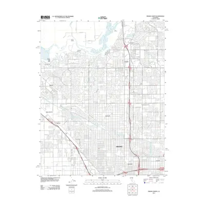
2012 Map of Fresno North
USGS Topo · Published 2012About this map
The San Joaquin River defines the northern edge of this urbanized landscape, where the northern expansion of Fresno meets the water's edge. This 2012 survey illustrates the dense residential and commercial grid that has matured around historic hubs like Pinedale and the established Fig Garden area. The intricate network of irrigation infrastructure, including the Herndon Canal, Victoria Canal, and the B Main Canal, serves as a reminder of the region's agricultural roots even as neighborhoods have largely replaced orchards and fields.
Find a feature on this map
84 named features on this map. Tap any name to fly to it.
Don’t see what you’re looking for? This feature index may not catch every label — zoom into the map to look around manually.
Map Details
Editions of this 2012 Fresno North Map
This is the sole edition of this map. No revisions or reprints were ever made.
Other maps of this area

1921 · Bullard
USGS Topo · 1:31,680

1922 · Lanes Bridge
USGS Topo · 1:31,680

1922 · Friant
USGS Topo · 1:31,680

1922 · Gregg
USGS Topo · 1:31,680

1923 · Kearney Park
USGS Topo · 1:31,680

1923 · Malaga
USGS Topo · 1:31,680

1923 · Herndon
USGS Topo · 1:31,680

1923 · Fresno
USGS Topo · 1:31,680

1923 · Clovis
USGS Topo · 1:31,680

1923 · Bullard
USGS Topo · 1:31,680