2015 Map of Fresno North
USGS Topo · Published 2015About this map
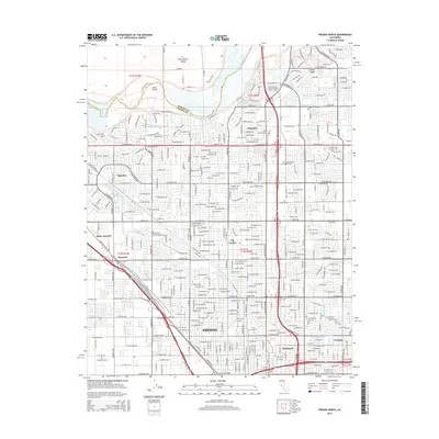
The San Joaquin River defines the northern boundary of this detailed topographic study, winding past Scout Island and under the Madera Co Fresno Co line. The urban expansion of Fresno is remarkably clear, showing the grid-heavy development reaching north toward Pinedale and Figarden. A complex web of water management infrastructure, including the Herndon Canal, Enterprise Canal, and the Bullard Canal, illustrates the intensive irrigation that sustains the San Joaquin Valley agricultural landscape. Moving south into the city, educational hubs such as Fresno City College and San Joaquin Valley College-Fresno serve as central landmarks within the residential blocks. The transit history of the region is anchored by the dual routes of the Southern Pacific RR and the Atchison Topeka & Santa Fe RR, which pass through historic junction points like Biola Junction and Muscatel on their way into the metropolitan core.
Find a feature on this map
136 named features on this map. Tap any name to fly to it.
Don’t see what you’re looking for? This feature index may not catch every label — zoom into the map to look around manually.
Map Details
Editions of this 2015 Fresno North Map
This is the sole edition of this map. No revisions or reprints were ever made.
Other maps of this area

1921 · Bullard
USGS Topo · 1:31,680

1922 · Lanes Bridge
USGS Topo · 1:31,680

1922 · Friant
USGS Topo · 1:31,680

1922 · Gregg
USGS Topo · 1:31,680

1923 · Kearney Park
USGS Topo · 1:31,680

1923 · Malaga
USGS Topo · 1:31,680

1923 · Herndon
USGS Topo · 1:31,680

1923 · Fresno
USGS Topo · 1:31,680

1923 · Clovis
USGS Topo · 1:31,680

1923 · Bullard
USGS Topo · 1:31,680