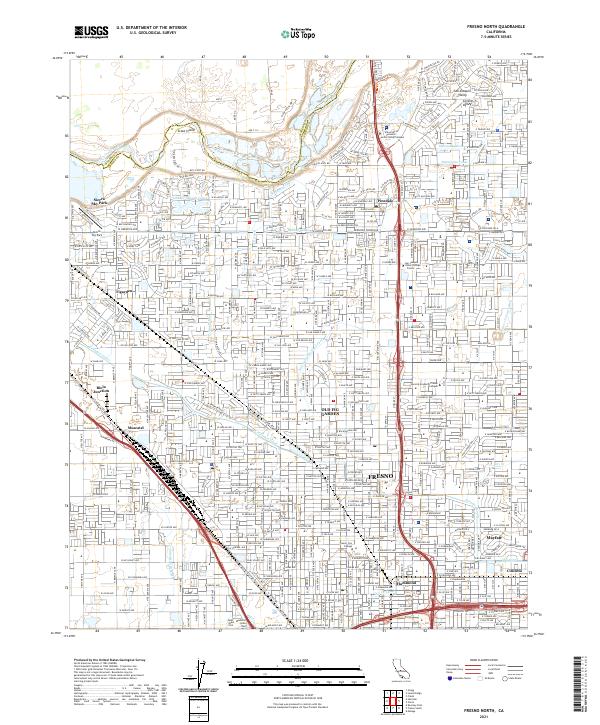
2021 Map of Fresno North
USGS Topo · Published 2021About this map
The San Joaquin River defines the northern boundary of this modern Fresno landscape, where the historic Scout Island sits just downstream from the Madera and Fresno county line. This map illustrates the dense network of irrigation and water management essential to the region, featuring the Enterprise Holland Canal, Forkner Canal, and Dry Creek Canal. The residential and commercial expansion of the early 21st century is visible in neighborhoods such as Old Fig Garden, Pinedale, and Mayfair. Transportation remains anchored by the BNSF Railway and Union Pacific lines, which cut through older industrial and agricultural nodes like Biola Junction and Muscatel. For researchers, the presence of Beth Israel Cem and Mountain View Cem near the southern edge provides significant points for genealogical study within the urban fabric.
Find a feature on this map
64 named features on this map. Tap any name to fly to it.
Don’t see what you’re looking for? This feature index may not catch every label — zoom into the map to look around manually.
Map Details
Editions of this 2021 Fresno North Map
This is the sole edition of this map. No revisions or reprints were ever made.
Other maps of this area

1921 · Bullard
USGS Topo · 1:31,680

1922 · Lanes Bridge
USGS Topo · 1:31,680

1922 · Friant
USGS Topo · 1:31,680

1922 · Gregg
USGS Topo · 1:31,680

1923 · Kearney Park
USGS Topo · 1:31,680

1923 · Malaga
USGS Topo · 1:31,680

1923 · Herndon
USGS Topo · 1:31,680

1923 · Fresno
USGS Topo · 1:31,680

1923 · Clovis
USGS Topo · 1:31,680

1923 · Bullard
USGS Topo · 1:31,680