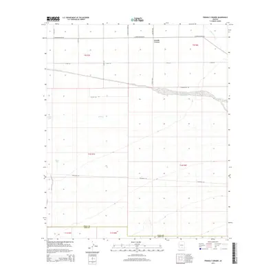
2014 Map of Friendly Corners
USGS Topo · Published 2014About this map
Friendly Corners serves as the primary landmark in this section of Pinal County, positioned at the intersection of a vast grid-iron road network and managed water systems. The landscape is defined by the ephemeral Santa Cruz River and the engineered Greene Canal, which cuts across the terrain to direct water through the arid region. The presence of several stock ponds or water catchments, such as Big Tank, Morris Tank, and Coffee Tank, indicates a landscape adapted for ranching or desert resource management. The map details the transition from the Pinal County flats toward the border of Pima County at the southern edge, where the terrain begins to rise and the road network, including S Toltec Hwy and S Sunshine Blvd, thins out. This survey captures a moment in the modern era where geometric land division and historic water rights intersect in the Arizona desert.
Find a feature on this map
23 named features on this map. Tap any name to fly to it.
Don’t see what you’re looking for? This feature index may not catch every label — zoom into the map to look around manually.
Map Details
Editions of this 2014 Friendly Corners Map
This is the sole edition of this map. No revisions or reprints were ever made.
Other maps of this area

1934 · Tucson Mountains
USGS Topo · 1:125,000

1934 · Silver Bell
USGS Topo · 1:125,000

1934 · Newman Peak
USGS Topo · 1:125,000

1947 · Red Rock
USGS Topo · 1:62,500

1947 · Eloy
USGS Topo · 1:62,500

1948 · Eloy
USGS Topo · 1:62,500

1956 · Tucson
USGS Topo · 1:250,000

1958 · Tucson
USGS Topo · 1:250,000

1959 · Tucson
USGS Topo · 1:250,000

1959 · Vaca Hills
USGS Topo · 1:62,500