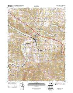
2013 Map of Front Royal
USGS Topo · Published 2013About this map
Shenandoah National Park anchors the southern portion of this landscape, where the Blue Ridge meets the valley floor near the confluence of the north and south forks of the Shenandoah River. This 2013 survey illustrates the complex rail-and-river geography of the area, featuring Riverton Junction and Front Royal Junction where the Norfolk Southern tracks navigate the water gaps. Historically significant industrial and residential clusters like Viscose City and Royal Village appear alongside modern infrastructure like the Wilson J Burke Senior Memorial Bridge. The map traces the winding paths of Happy Creek and Leach Run through established neighborhoods such as Woodland Park and Mountain View, while the north features rural communities like Rockland and Success. Landforms like Guard Hill and Dismal Hollow provide a clear topographic context for the regional transportation hub.
Find a feature on this map
96 named features on this map. Tap any name to fly to it.
Don’t see what you’re looking for? This feature index may not catch every label — zoom into the map to look around manually.
Map Details
Editions of this 2013 Front Royal Map
This is the sole edition of this map. No revisions or reprints were ever made.
Other maps of this area

1893 · Luray
USGS Topo · 1:125,000

1894 · Winchester
USGS Topo · 1:125,000

1905 · Luray
USGS Topo · 1:125,000

1923 · Middletown
USGS Topo · 1:62,500

1937 · Middletown
USGS Topo · 1:48,000

1938 · Winchester
USGS Topo · 1:48,000

1939 · Front Royal
USGS Topo · 1:48,000

1942 · Winchester
USGS Topo · 1:62,500

1943 · Middletown
USGS Topo · 1:62,500

1944 · Front Royal
USGS Topo · 1:62,500