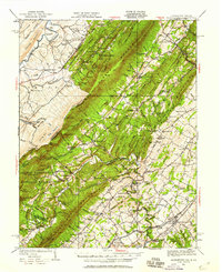
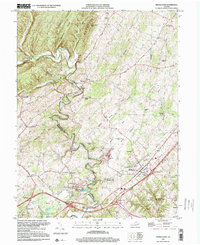
1923 Map of Middletown
USGS Topo · Published 1923About this map
The Cacapon River winds through the valley floor of the Great North Mountain region, defining a landscape of small settlements and river crossings like Arnolds Ford and Davis Ford. This 1923 edition, based on earlier surveys by D.H.Watson and others, shows a rural economy centered on the river and its tributaries, including Old Man Run and Lick Branch. The eastern slope of North Mountain marks the rugged boundary between Hampshire and Frederick counties, where landforms like Pinnacle and Eagle Rock dominate the skyline.
Find a feature on this map
35 named features on this map. Tap any name to fly to it.
Don’t see what you’re looking for? This feature index may not catch every label — zoom into the map to look around manually.
Map Details
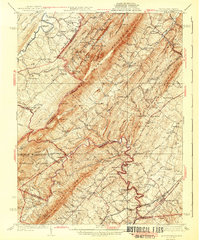
Editions of this 1923 Middletown Map
This is the sole edition of this map. No revisions or reprints were ever made.
Historical Maps of Strasburg Through Time
8 maps found