
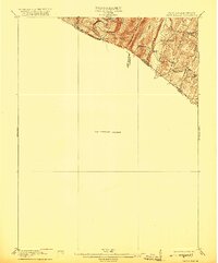
1916 Map of Capon Bridge
USGS Topo · Published 1916About this map
The Cacapon River winds through the northern corner of this territory, marking a landscape defined by the parallel elevations of Sideling Hill and Cacapon Mountain. This 1914 survey captures a moment when the rural economy relied on centralized community landmarks such as Enon School and Birch Grove School, which served the scattered residents of Largent and the surrounding hollows.
Find a feature on this map
22 named features on this map. Tap any name to fly to it.
Don’t see what you’re looking for? This feature index may not catch every label — zoom into the map to look around manually.
Map Details
Editions of this 1916 Capon Bridge Map
2 editions found
Other maps of this area

1891 · Romney
USGS Topo · 1:125,000

1894 · Winchester
USGS Topo · 1:125,000

1898 · Paw Paw
USGS Topo · 1:62,500

1899 · Flintstone
USGS Topo · 1:62,500

1899 · Hancock
USGS Topo · 1:62,500

1900 · Pawpaw
USGS Topo · 1:62,500

1900 · Flintstone
USGS Topo · 1:62,500

1901 · Hancock
USGS Topo · 1:62,500

1910 · Paw Paw
USGS Topo · 1:62,500

1914 · Gerrardstown
USGS Topo · 1:48,000