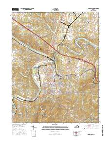
2016 Map of Front Royal
USGS Topo · Published 2016About this map
Front Royal serves as the focal point of this 2016 survey, situated at the junction of the North Fork Shenandoah River and South Fork Shenandoah River. The map documents the intricate residential and industrial layout of the town, including distinctive neighborhoods like Viscose City, Chimney Field, and Dungadin Heights. To the south, the terrain rises sharply into Shenandoah National Park, where Dickey Ridge and the Appalachian National Scenic Trail dominate the landscape. The confluence at Riverton Junction highlights the area's historic reliance on river and rail transport, while several cemeteries, including Prospect Hill Cem and Rockland Community Cem, provide essential data for genealogical research. The northern reaches show a transition to more rural communities like Rockland and Success, contrasted with the specialized infrastructure of the Front Royal-Warren County Airport.
Find a feature on this map
55 named features on this map. Tap any name to fly to it.
Don’t see what you’re looking for? This feature index may not catch every label — zoom into the map to look around manually.
Map Details
Editions of this 2016 Front Royal Map
This is the sole edition of this map. No revisions or reprints were ever made.
Other maps of this area

1893 · Luray
USGS Topo · 1:125,000

1894 · Winchester
USGS Topo · 1:125,000

1905 · Luray
USGS Topo · 1:125,000

1923 · Middletown
USGS Topo · 1:62,500

1937 · Middletown
USGS Topo · 1:48,000

1938 · Winchester
USGS Topo · 1:48,000

1939 · Front Royal
USGS Topo · 1:48,000

1942 · Winchester
USGS Topo · 1:62,500

1943 · Middletown
USGS Topo · 1:62,500

1944 · Front Royal
USGS Topo · 1:62,500