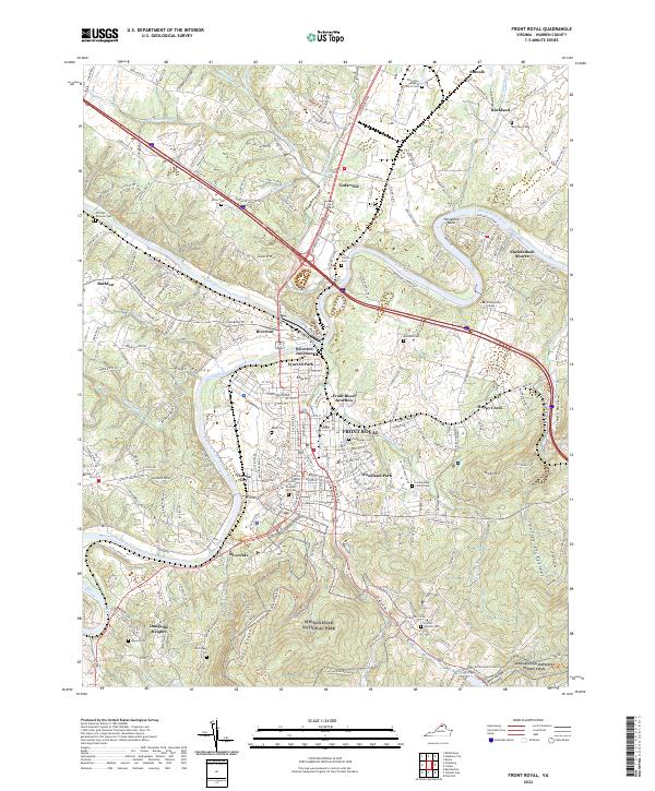
2022 Map of Front Royal
USGS Topo · Published 2022About this map
Front Royal and the surrounding Page Valley are defined by the convergence of the North Fork Shenandoah River and South Fork Shenandoah River. This 2022 survey documents the complex geography of the area, from the industrial heritage of Viscose City to the institutional prominence of the Warren County Courthouse. The northern reaches of Shenandoah National Park dominate the southern portion of the map, where the Appalachian National Scenic Trail winds along Dickey Ridge. Genealogists will find a high density of family and community burial grounds, including Prospect Hill Cem, Ash Family Cem, and Rockland Cem. The transition from the riverfront terrain at Riverton Junction to the higher elevations of Catlett Mtn and Green Hill illustrates the varied landscape of Warren County.
Find a feature on this map
55 named features on this map. Tap any name to fly to it.
Don’t see what you’re looking for? This feature index may not catch every label — zoom into the map to look around manually.
Map Details
Editions of this 2022 Front Royal Map
This is the sole edition of this map. No revisions or reprints were ever made.
Other maps of this area

1893 · Luray
USGS Topo · 1:125,000

1894 · Winchester
USGS Topo · 1:125,000

1905 · Luray
USGS Topo · 1:125,000

1923 · Middletown
USGS Topo · 1:62,500

1937 · Middletown
USGS Topo · 1:48,000

1938 · Winchester
USGS Topo · 1:48,000

1939 · Front Royal
USGS Topo · 1:48,000

1942 · Winchester
USGS Topo · 1:62,500

1943 · Middletown
USGS Topo · 1:62,500

1944 · Front Royal
USGS Topo · 1:62,500