
1966 Map of Fulda
USGS Topo · Published 1968About this map
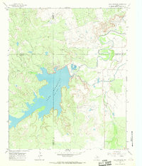
The Fort Worth and Denver railroad cuts a straight line across this north Texas landscape, connecting the small settlement of Fulda to the broader regional economy in the mid-1960s. This transition between ranching and industry is evident in the presence of numerous Corrals alongside the Seymour Oil Field to the south. The drainage patterns of the North Fork Little Wichita River and its many tributaries, such as Coal Creek and Timber Creek, create a deeply dissected terrain of draws and hollows like Wolf Hollow. Human infrastructure is sparse but specialized, marked by a lonely Landing Strip and a remote Substa, illustrating the utility of the land for both petroleum extraction and livestock management during this era of rural Texas development.
Find a feature on this map
16 named features on this map. Tap any name to fly to it.
Don’t see what you’re looking for? This feature index may not catch every label — zoom into the map to look around manually.
Map Details
Editions of this 1966 Fulda Map
This is the sole edition of this map. No revisions or reprints were ever made.
Other maps of this area

1932 · Dundee
USGS Topo · 1:62,500

1954 · Wichita Falls
USGS Topo · 1:250,000

1958 · Wichita Falls
USGS Topo · 1:250,000

1963 · Dundee
USGS Topo · 1:24,000

1963 · Dundee SW
USGS Topo · 1:24,000

1966 · Franklin Bend
USGS Topo · 1:24,000
1966 · Lake Diversion
USGS Topo · 1:24,000

1966 · Northeast Lake Kemp
USGS Topo · 1:24,000

1966 · Southeast Lake Kemp
USGS Topo · 1:24,000

1966 · Seymour East
USGS Topo · 1:24,000