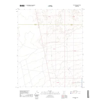
2023 Map of Fuller Ranch
USGS Topo · Published 2023About this map
The boundary between Socorro Co and Sierra Co divides this high-desert territory, characterized by vast expanses of open range and isolated ranching infrastructure. Managed largely by the U.S. Department of the Interior and the U.S. Geological Survey, the landscape is defined by its strategic and agricultural utility. To the southeast, the terrain transitions into the restricted perimeter of the White Sands Missile Range, a significant federal installation that dominates the regional geography. Water management is central to life in this arid environment, evidenced by isolated features like Middle Tank and AAA Tank. Movement through the area is facilitated by unimproved routes such as Fuller Rd and Co Rd A031, which trace the township lines including t10s r1e and t11s r2e.
Find a feature on this map
12 named features on this map. Tap any name to fly to it.
Don’t see what you’re looking for? This feature index may not catch every label — zoom into the map to look around manually.
Map Details
Editions of this 2023 Fuller Ranch Map
This is the sole edition of this map. No revisions or reprints were ever made.
Other maps of this area

1916 · Salinas Peak
USGS Topo · 1:125,000

1948 · Granjean Well
USGS Topo · 1:62,500

1948 · Val Verde
USGS Topo · 1:62,500

1948 · Malpais Well
USGS Topo · 1:62,500

1948 · Salinas Peak
USGS Topo · 1:62,500

1954 · Tularosa
USGS Topo · 1:250,000

1958 · Tularosa
USGS Topo · 1:250,000

1981 · Big Gyp Mountain
USGS Topo · 1:24,000
1981 · Fence Canyon
USGS Topo · 1:24,000
1981 · Fairview Well
USGS Topo · 1:24,000